3D Laser Scanning in Arizona
Scan-to-BIM and as-built documentation for projects across Arizona
Know the Site Before You Design or Dig
Architects, contractors and building owners across Arizona, from Phoenix and Tucson to Flagstaff, Prescott, Sedona and Yuma, call Line & Circle when they cannot afford to guess at existing conditions. We scan whole buildings, historic structures and larger facilities with terrestrial LiDAR, then turn the data into models and drawings your team can build from.
Based in Gold Canyon, Arizona, we serve projects across the state and work with project teams nationwide. We focus on buildings, historic structures and larger facilities, not small or single-room scans.
What We Scan
- Whole buildings, inside and out, ahead of renovations, additions and adaptive reuse
- Historic structures and landmarks that need accurate documentation before any work begins
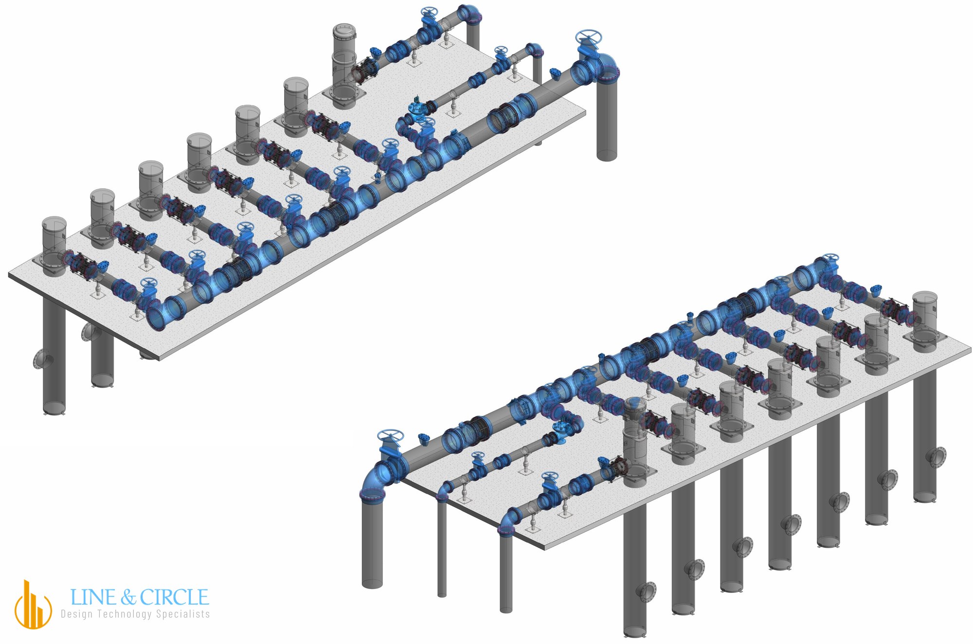
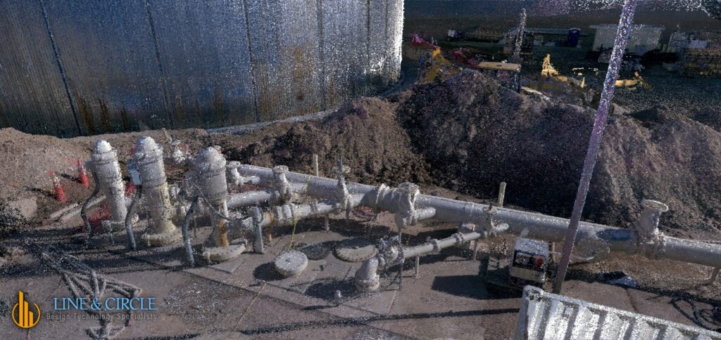
- Commercial, medical and industrial facilities, including plants and pump yards
- Existing structure, piping and equipment that new work must tie into with confidence
How It Works
- Scan: terrestrial LiDAR captures the site as a dense, measured point cloud, with minimal disruption to your operations
- Verify: the scan data is registered and checked, so the model is built on measured conditions
- Model and deliver: Revit models, plan sheets and point cloud files your team can use directly
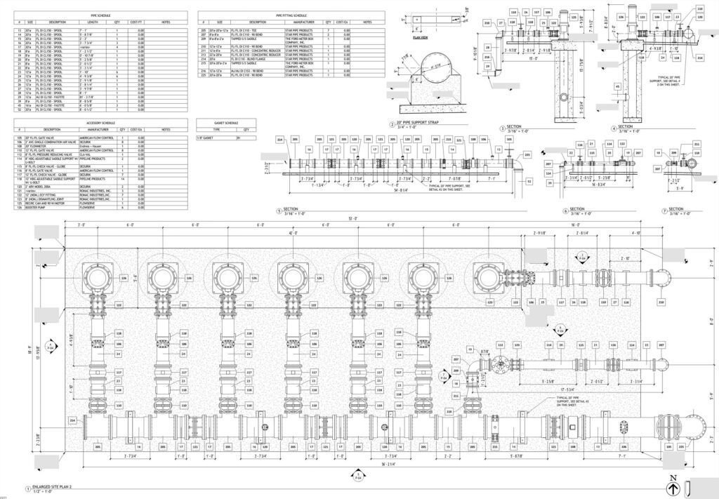
What You Receive
A coordinated Revit model, plan sheets and the point cloud behind them, organized so every trade works from the same picture. We deliver files your team can open and build from.
Why Arizona Teams Scan First
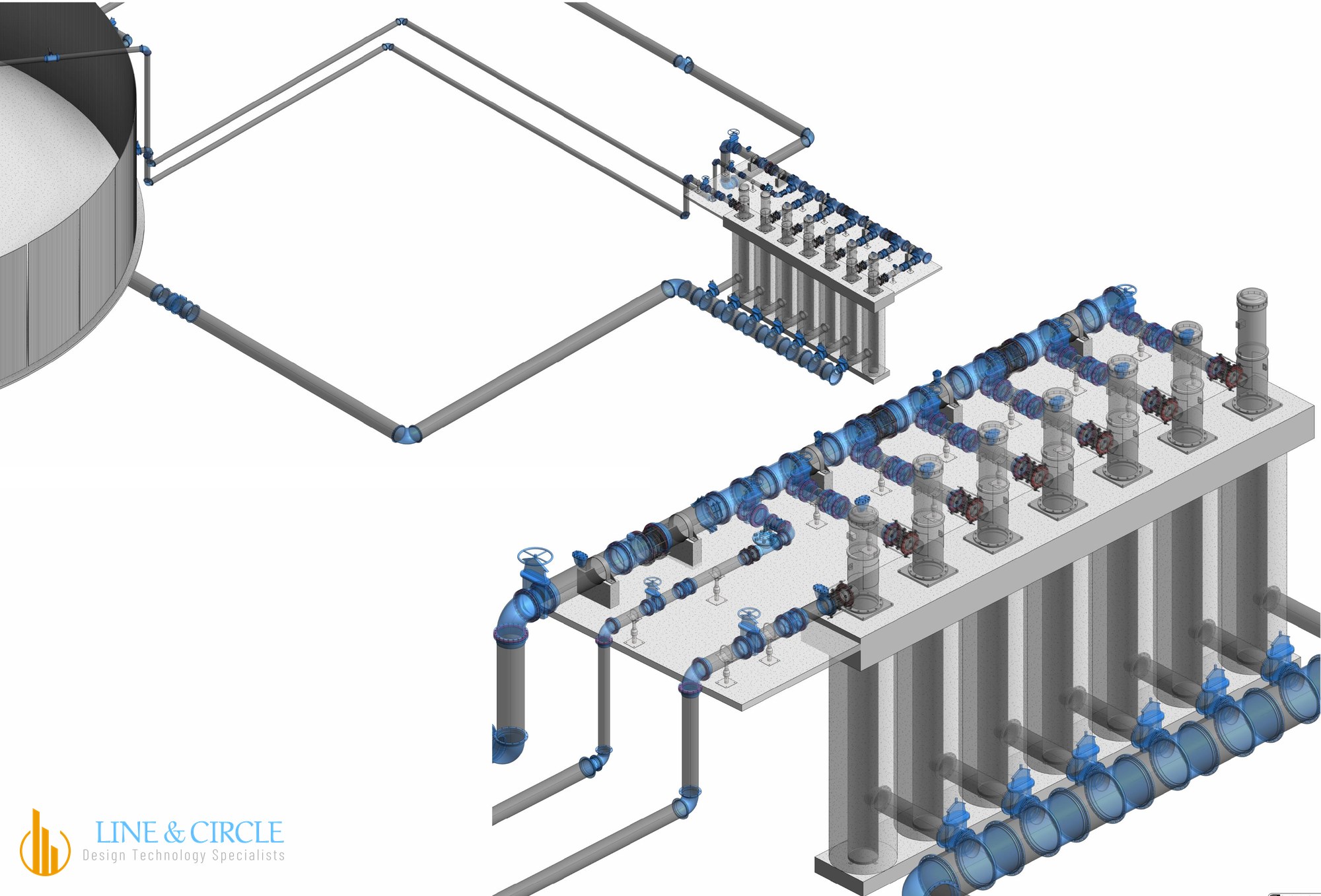
Designs are checked against measured conditions before work begins
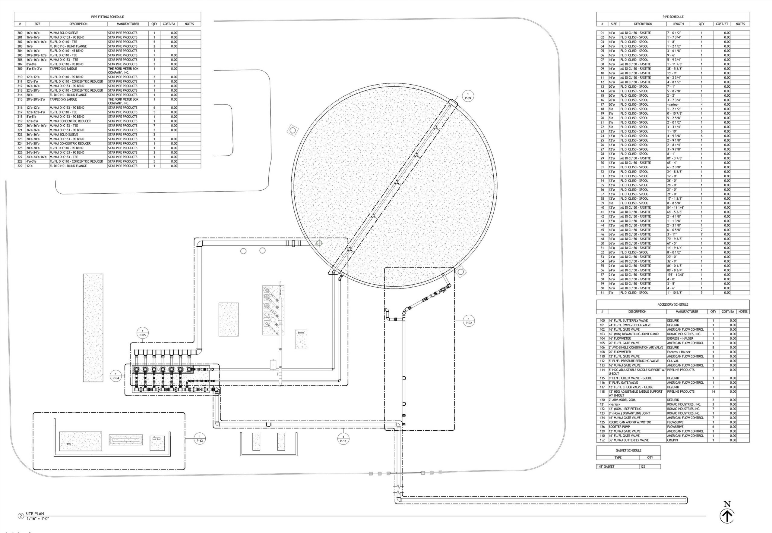
One coordinated record of existing and new work, so conflicts show up on screen, not in the field
From Scan to Model
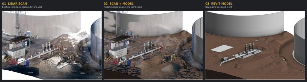
See how this played out on a real project.
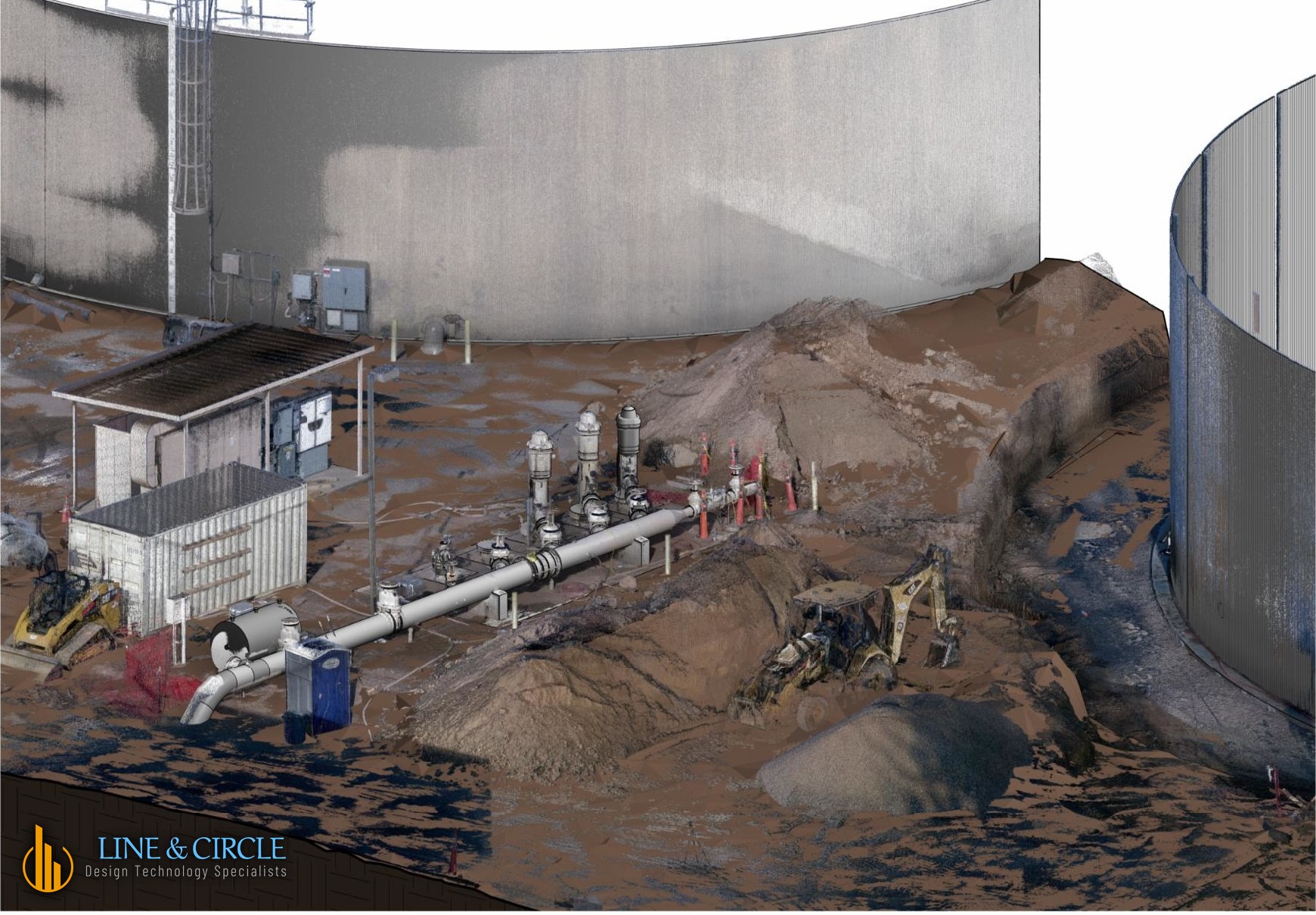
Read the case study of a water facility scanned and modeled for a Phoenix-area contractor.
Areas We Serve
From our base in Gold Canyon, we serve projects statewide, including Phoenix, Tucson, Flagstaff, Prescott, Sedona, Yuma, Pinal County and the communities in between. Projects across the country are welcome too.
Accuracy and Quality Control
- Measured, not estimated: terrestrial LiDAR captures the site with 1/8 inch precision.
- Scan data is registered and checked before any modeling starts.
- Models are compared against the point cloud before delivery.
- Deliverables are organized so your team can open them and build from them.
Historic Preservation Scanning in the Phoenix Area
Arizona is full of buildings and structures that deserve careful documentation. We capture historic buildings and landmarks with the detail that preservation, restoration and adaptive reuse work depends on, and we have documented sites across the state, including the Audrey Headframe in Jerome and the Stamp Mill. See our historic preservation work.
From Scan to BIM
From the point cloud we produce Revit models, plans, sections and elevations, and coordinated models your design team can work from. Learn more about our reality capture and BIM modeling services, or read how we scanned and modeled a water facility for a Phoenix-area contractor.
Arizona Laser Scanning FAQ
How accurate is 3D laser scanning?
LiDAR scanning measures the site directly, and we model to a tolerance of 1/8 inch, so your design starts from measured conditions instead of assumptions.
Will scanning disrupt our site or operations?
Scanners are quiet and unobtrusive. We plan the work around your schedule, and we have scanned active sites with crews and equipment working nearby.
What do we receive?
Depending on scope: the point cloud, a coordinated Revit model and plan sheets, organized so every trade works from the same information.
Can you scan while construction is still under way?
Yes. We scanned a water facility with its tank only partly built, then modeled the existing conditions so the new piping could be designed against them.
Do you work in Arizona summer heat?
Yes. We plan scanning around site conditions, including early starts during the hottest months.
Where are you based, and who do you serve?
Line & Circle is based in Gold Canyon, Arizona. We serve projects across Arizona and work with project teams nationwide.
How do we get started?
Tell us about your site and what you need to know before work begins. We will respond promptly with what we would scan and what you would get back.